Image Prompt: A professional land surveyor using a total station while a second crew member holds a prism pole in an open Utah landscape with dramatic red rock formations and a wide blue sky, natural daylight, photorealistic, wide horizontal composition, no text overlay, 1536×1024.
What Is the Best Land Survey Method?
Introduction
With so many different tools and techniques available today, it is easy to wonder what is the best land survey method. The honest answer is that there is no single method that works best in every situation. However, understanding how the most common survey methods work and when each one is the right choice helps you make smarter decisions about your property. In this article, we break down the leading survey methods used across Utah, compare their strengths and limitations, and help you understand how experienced surveyors choose the right approach for each project.
Why the Best Method Depends on the Project
Every survey project is different. A residential boundary survey on a flat suburban lot in Salt Lake City calls for a different approach than a topographic survey across a steep canyon property in southern Utah. Because of this, experienced surveyors do not rely on a single method. Instead, they select and combine methods based on the specific needs of each project.
The key factors that influence method selection include:
- The type of survey being performed
- The size and shape of the property
- The terrain and vegetation on and around the site
- The level of accuracy required
- The time and budget available for the project
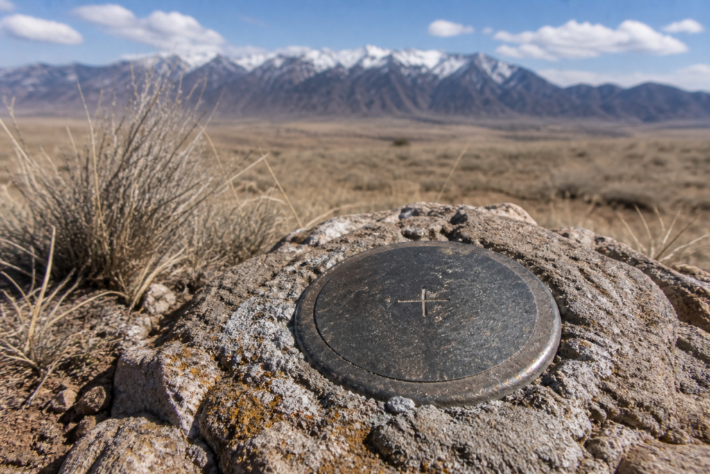
- The availability of existing control points and historical records
With those factors in mind, here is a look at the most widely used survey methods and what makes each one effective.
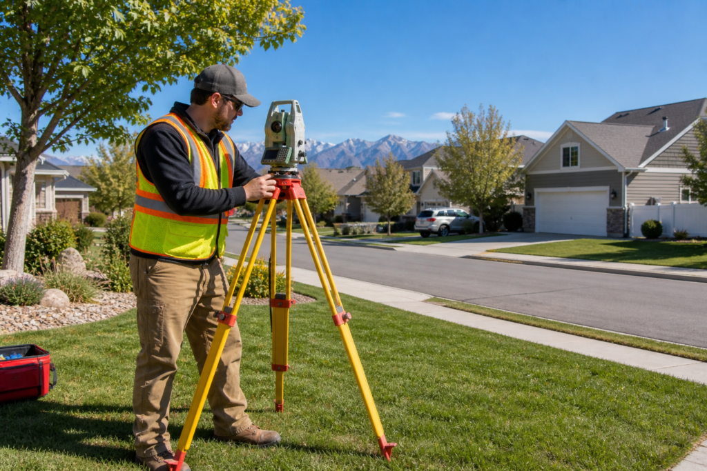
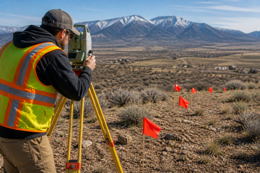
Total Station Surveying
The total station is one of the most reliable and widely used instruments in professional land surveying. It combines electronic distance measurement with precise angle measurement to collect highly accurate positional data from a single setup point.
Total station surveying works especially well for:
- Boundary surveys on residential and commercial properties
- Construction staking and layout work
- Surveys in areas with limited satellite visibility such as urban canyons or heavily wooded sites
- Detailed topographic work on smaller properties
- Any project where millimeter level accuracy is required
One of the biggest advantages of total station surveying is its reliability in challenging environments. Because it does not depend on satellite signals, it performs consistently even in areas where GPS struggles. Furthermore, a skilled surveyor can collect highly accurate data quickly and efficiently with a well-calibrated total station.
RTK GPS Surveying
Real Time Kinematic GPS is one of the most powerful tools in modern surveying. As we discussed in our article on Modern Land Surveying Technology in Utah: How Accuracy Has Improved, RTK GPS delivers centimeter level accuracy by combining satellite positioning with real time corrections from a base station.
RTK GPS surveying works especially well for:
- Large rural or agricultural properties with open sky visibility
- Pipeline and utility corridor surveys across long distances
- Topographic data collection on open terrain
- GIS data collection and mapping projects
- Projects that cover large geographic areas efficiently
The main advantage of RTK GPS is speed. A surveyor with an RTK rover can cover ground far faster than traditional optical methods allow. Because of this, GPS is the preferred method for large scale projects where efficiency matters as much as accuracy.
However, RTK GPS does have limitations in areas with heavy tree cover, deep canyons, or dense urban environments. In those situations, total station methods or a combination approach delivers better results.
Drone Mapping
Drone surveying has become one of the most exciting developments in the profession over the past decade. Using unmanned aerial vehicles equipped with high resolution cameras and GPS receivers, surveyors can collect detailed aerial data across large areas in a fraction of the time traditional methods require.
Drone mapping works especially well for:
- Large area topographic surveys
- Volumetric calculations for earthwork and mining projects
- Aerial mapping of remote or difficult to access terrain
- Progress monitoring on large construction sites
- Environmental and land use mapping
At Cook Surveying & Associates, our drone mapping services allow us to collect high quality data safely and efficiently across Utah’s diverse landscape. From open desert to rugged mountain terrain, drones give us a powerful tool for projects where traditional ground based methods would take far longer.
That said, drone surveys require ground control points to achieve the highest levels of accuracy. Because of this, drone mapping is often combined with traditional GPS or total station work to produce the best possible results.
Traditional Optical Methods
Before GPS and total stations became standard, surveyors relied on optical instruments like transits and theodolites to measure angles, combined with steel chains or tapes to measure distances. While these methods have largely been replaced by modern technology, they are still relevant in certain situations.
Traditional optical methods are still used for:
- Verifying measurements made with modern equipment
- Working in environments where electronic equipment is restricted or unreliable
- Historical resurveys where original methods need to be replicated
- Educational and training purposes
Furthermore, understanding traditional methods is important for any licensed surveyor because many older surveys were performed using these techniques. Being able to interpret and work with those historical records is an essential skill, especially in Utah where some property records go back well over a century.
The Combined Approach: Why the Best Surveyors Use Multiple Methods
In practice, the best survey method is rarely a single technique used in isolation. Instead, experienced surveyors combine methods strategically to get the most accurate and efficient results possible.
For example, a typical boundary survey on a complex Utah property might involve:
- RTK GPS to establish control points quickly and tie the survey into the national reference system
- A total station to measure precise angles and distances along the boundary
- Drone mapping to capture topographic data across a larger area efficiently
- Traditional research and record review to understand the property’s legal history
By combining these methods thoughtfully, a skilled surveyor achieves results that are faster, more accurate, and more comprehensive than any single method could deliver on its own. As a result, the question is not which method is best in absolute terms. It is which combination of methods is best for your specific project.
How Utah’s Terrain Affects Method Selection
Utah presents some unique surveying challenges that make method selection especially important. The state’s dramatic landscape includes everything from flat valley floors to steep canyon walls, dense forests, open desert, and high alpine terrain.
Because of this variety, Utah surveyors need to be comfortable with all of the major survey methods and know when to switch approaches. For instance:
- Open desert terrain in southern Utah is ideal for RTK GPS and drone mapping
- Heavily wooded mountain properties near the Wasatch Front often require total station work
- Deep canyon properties in areas like Zion or Bryce require careful planning and often a combination of methods
- Urban properties in Salt Lake City or Provo may face multipath GPS errors that make total stations the better primary tool
That local knowledge and flexibility is one of the most important things an experienced Utah surveying firm brings to every project.
Key Takeaways
- There is no single best survey method for every situation
- Total station surveying delivers high precision in challenging environments where GPS struggles
- RTK GPS is fast and accurate across large open properties
- Drone mapping is ideal for large area topographic and aerial data collection
- The best results come from combining methods strategically based on project needs
- Utah’s varied terrain makes method selection especially important
- Always work with a licensed surveyor who understands both the technology and the local landscape
Helpful Resources
- National Society of Professional Surveyors (NSPS) — professional standards, education, and resources for land surveyors nationwide
- Utah Association of Land Surveyors (UALS) — Utah specific licensing, continuing education, and professional networking for surveyors and property owners
Conclusion
So what is the best land survey method? The best method is the one that matches your project, your property, and your goals. For most Utah property owners, that means working with a licensed surveyor who understands the full range of tools available and knows how to combine them effectively. Whether that means RTK GPS across open desert terrain, a total station in a tight urban lot, or drone mapping on a large development site, the right approach makes all the difference.
At Cook Surveying & Associates, we bring the full toolkit to every project. Our licensed team selects and combines methods based on what your specific property and project actually need, not just what is easiest or fastest.
Contact Cook Surveying & Associates today and let us find the best approach for your next survey project.