After you receive a land survey, it’s common to feel overwhelmed. Many homeowners look at the document and immediately ask: how do I read a land survey report?
Fortunately, once you understand the basics, a land survey becomes much easier to follow.
This guide explains how to read and understand your land survey report so you can confidently use it for building, fencing, or property decisions.
What Is a Land Survey Report?
A land survey report is a legal document created by a licensed land surveyor. It shows property boundaries, measurements, and important features affecting your land.
Surveyors prepare these reports using historical records, field measurements, and professional standards. In Utah, surveyors must follow licensing rules overseen by the Utah Division of Professional Licensing, which you can review at https://dopl.utah.gov.
Start With the Title Block
First, look at the title block, usually located near the bottom or corner of the survey.
The title block typically includes:
- Property address or legal description
- Survey type
- Date of the survey
- Surveyor’s name and license number
Because surveys reflect conditions at a specific point in time, always check the date first.
Understanding Property Lines and Boundary Markings
Next, focus on the property lines. These lines show the legal boundaries of your land.
Surveyors usually draw:
- Bold or solid lines for property boundaries
- Measurements listed along each boundary
- Corner markers such as iron pins or monuments
If structures appear close to boundary lines, the survey helps confirm whether everything sits within the correct area.
What the Measurements Mean
Measurements show distances and angles between property corners. These numbers ensure accuracy and consistency.
Although the measurements may look technical, their purpose is simple. They show exactly how far one boundary extends and where each corner sits.
If measurements don’t match visible fences or landscaping, trust the survey, not the physical features.
Reading Symbols and Notations
Land surveys use symbols and abbreviations to save space. While these symbols vary slightly, many follow national standards.
Common symbols may represent:
- Easements
- Utility lines
- Fences or walls
- Buildings and driveways
Professional standards for surveying symbols and documentation are guided by organizations such as the American Congress on Surveying and Mapping, which provides industry resources at https://www.acsm.net.
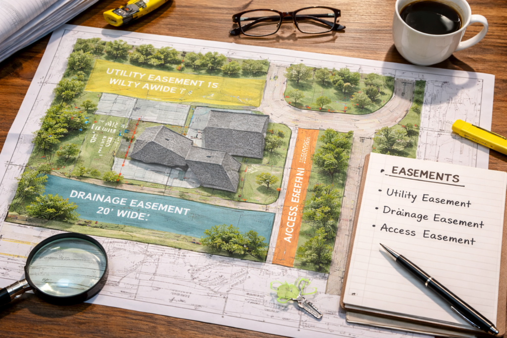
Easements and Rights of Way
Easements allow others limited use of part of your property. These often appear as dashed lines or labeled areas on the survey.
Common easements include:
- Utility access
- Drainage paths
- Shared driveways
Understanding easements matters because they can limit where you build or modify land.
Why the Surveyor’s Certification Matters
Near the bottom of the report, you’ll find the surveyor’s certification. This section confirms that a licensed professional completed the work according to legal standards.
Because of this certification, lenders, courts, and municipalities recognize survey reports as official documents.
When to Ask Questions About Your Survey
Even with a clear report, questions may come up. You should contact your surveyor if:
- Boundaries appear closer than expected
- Structures seem near or over property lines
- Easements affect planned improvements
Asking early prevents misunderstandings later.
You can also learn how different surveys serve different purposes in our related article, Understanding the Different Types of Land Surveys in Utah, at https://www.cooksurveying.com/types-of-land-surveys-utah/.
Frequently Asked Questions About Land Survey Reports
Is a land survey report legally binding?
Yes. A licensed surveyor’s report carries legal weight.
Can I use a survey report for permits?
In many cases, yes. Cities often require surveys for building approvals.
Do survey reports expire?
They don’t expire, but changes to the property may require an updated survey.
Why doesn’t my fence match the survey lines?
Fences often get built without surveys. The survey shows the true boundary.
Should I keep a copy of my survey?
Yes. Keep both digital and printed copies with your property records.
Conclusion: Understanding Your Land Survey Report
Knowing how to read a land survey report helps you protect your property and avoid costly mistakes. Once you understand boundaries, measurements, and easements, the document becomes a powerful planning tool rather than a confusing drawing.