If you have ever needed a survey and felt overwhelmed by all the different options, you are not alone. There are many types of land surveys, and each one serves a different purpose. However, one type comes up more than any other for property owners across Utah. If you are asking what is the most common type of land survey, the answer is the boundary survey. In this article, we explain what a boundary survey is, why it is so widely used, and when you might need one for your property.
What Is a Boundary Survey?
A boundary survey is a professional measurement and mapping of a property’s legal boundaries. In other words, it shows exactly where your property begins and ends. A licensed Professional Land Surveyor researches historical records, deeds, and prior surveys, then goes into the field to locate or set physical monuments at each corner of the property.
The result is a legal document that clearly shows:
- The exact dimensions and shape of the property
- The location of all property corners and boundary lines
- Any encroachments, overlaps, or gaps with neighboring properties
- Easements and other restrictions that affect the boundary
- The relationship between the legal description and the actual ground measurements
Because boundary surveys are used in so many different situations, they are by far the most frequently requested type of survey across Utah and the rest of the country.
Why Is the Boundary Survey So Common?
The boundary survey is the most common type of land survey for a simple reason. Almost every property transaction, construction project, or land dispute eventually comes back to one fundamental question: where exactly is the property line? A boundary survey answers that question with legal precision.
Furthermore, boundary surveys are required or strongly recommended in a wide range of everyday situations that Utah property owners encounter regularly.
Common reasons people order boundary surveys include:
- Buying or selling a home or piece of land
- Resolving a dispute with a neighbor over a fence, driveway, or structure
- Planning a new construction project, addition, or outbuilding
- Subdividing a larger parcel into smaller lots
- Applying for a building permit
- Refinancing a property or securing a new mortgage
- Confirming that an existing fence or structure is in the right location
Because of this broad range of applications, boundary surveys touch the lives of homeowners, developers, real estate professionals, and attorneys on a daily basis.
How Does a Boundary Survey Work?
Understanding the process helps you know what to expect when you order a boundary survey. In general, a boundary survey involves three main phases.
Phase 1: Research and Record Review
Before heading into the field, your surveyor spends time researching the property’s history. This includes reviewing deeds, prior surveys, plat maps, and any other recorded documents that describe the property or its boundaries. In addition, the surveyor checks for easements, right of way records, and any notes from neighboring surveys that might affect the boundary.
This research phase is critical because it gives the surveyor the information needed to correctly interpret what they find in the field. In Utah, where land records can go back well over a hundred years and properties were sometimes described using old metes and bounds methods, this research can be quite involved.
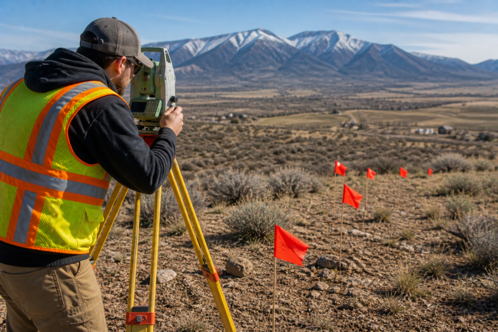
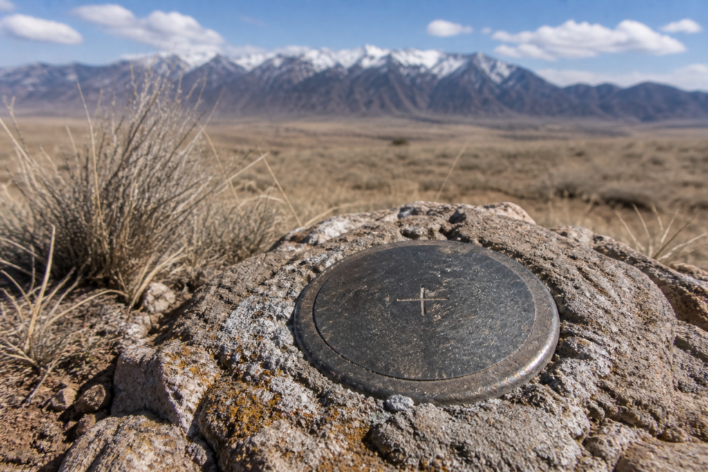
Phase 2: Field Work
Once the research is complete, the surveyor heads into the field to locate existing monuments, measure the property, and set new corners where needed. Using high precision equipment like total stations and RTK GPS, the surveyor collects measurements that are accurate to within fractions of an inch.
During field work, the surveyor also looks for evidence of encroachments, improvements, and any physical features that might affect the boundary determination. Because of this, field work is not just about measuring. It is also about observing and interpreting what is on the ground.
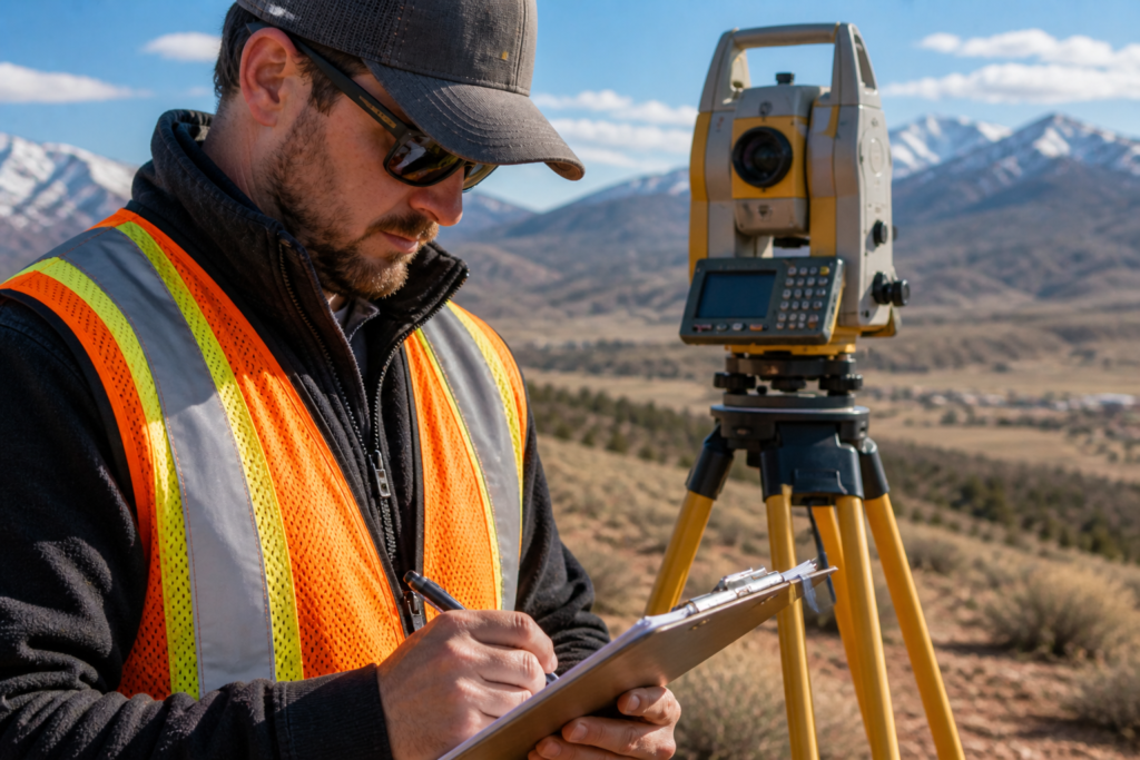
Phase 3: Map Preparation and Certification
After the field work is complete, the surveyor returns to the office to process the data and prepare the final survey map. This map shows all of the boundary information in a clear, readable format. Once it is reviewed and approved, the licensed PLS stamps and certifies the document, making it a legally recognized record.
Boundary Surveys vs. Other Common Survey Types
While boundary surveys are the most common, it helps to understand how they compare to a few other frequently requested survey types in Utah.
- Topographic surveys measure the shape and elevation of the land rather than just its boundaries. They are essential for construction and engineering planning but serve a different purpose than a boundary survey.
- ALTA/NSPS surveys are a more comprehensive version of a boundary survey used primarily for commercial real estate transactions. They follow strict national standards and cover far more detail than a standard boundary survey.
- Construction surveys use boundary information as a starting point but focus on staking out building footprints, grades, and site improvements for construction crews.
In many cases, a boundary survey is the first step that makes all other survey types possible. You can read more about the full range of options in our article on Understanding the Different Types of Land Surveys in Utah.
Do You Always Need a Boundary Survey?
Not every situation calls for a boundary survey. However, there are several cases in Utah where getting one is either legally required or simply the smart thing to do.
You should strongly consider a boundary survey when:
- You are purchasing a property and want to know exactly what you are buying
- You plan to build anything near a property line
- A neighbor has questioned or disputed your boundary
- You want to add a fence and need to know where the line actually is
- You are dividing land or creating a new lot
- Your lender or title company requires one as part of a transaction
On the other hand, if you simply need a rough idea of your property size for personal reference, other less expensive options may be available. However, for anything legally significant, a boundary survey performed by a licensed PLS is the right choice every time.
Key Takeaways
- The boundary survey is the most common type of land survey in Utah and across the country
- It establishes the exact legal boundaries of a property using field measurements and historical records
- Boundary surveys are used for real estate transactions, construction projects, neighbor disputes, and more
- The process includes research, field work, and map preparation and certification
- Boundary surveys are different from topographic, ALTA, and construction surveys but often serve as the foundation for them
- Always hire a licensed Professional Land Surveyor for legally binding boundary work
Helpful Resources
- National Society of Professional Surveyors (NSPS) — national standards, education, and advocacy for professional land surveyors
- Utah Association of Land Surveyors (UALS) — Utah specific licensing information, continuing education, and professional resources
Conclusion
So what is the most common type of land survey? The boundary survey is the clear answer. Because it addresses the most fundamental question in property ownership — where is the line — it comes up in more situations than any other survey type. Whether you are buying a home, planning a project, or resolving a dispute, a boundary survey gives you the legally precise answer you need.
At Cook Surveying & Associates, boundary surveys are at the core of what we do. Our licensed team brings decades of experience and deep knowledge of Utah’s land records, terrain, and regulations to every project we take on.
Contact Cook Surveying & Associates today and let us help you get the answers your property deserves.