Utah’s diverse landscape isn’t just mountains and desert. Many homes are nestled near lakes, rivers, irrigation canals and drainage basins. If your property borders or contains a water feature, understanding what lies beneath the surface is just as important as knowing where your fence should sit. Hydrographic surveys map underwater terrain, reveal hidden hazards and clarify legal water boundaries. This guide explains what hydrographic surveying is, why it matters to homeowners and how it can help you protect your investment.
What is a hydrographic survey?
Think of a hydrographic survey as an underwater counterpart to a traditional boundary or topographic survey. Surveyors measure and map the physical characteristics of rivers, lakes and other water bodies, creating charts that show depth, bottom composition and hazards. A comprehensive guide from JOUAV describes hydrographic surveys as “underwater X‑rays” that map water depth, seabed composition, submerged hazards and water properties such as currents and tides【113824195896721†L132-L145】. These surveys use sonar and remote‑sensing equipment to collect data and then translate it into detailed maps or digital models. The resulting charts allow engineers, boaters and landowners to understand what they can’t see from the surface.
Why homeowners might need a hydrographic survey
While hydrographic surveying is often associated with ports and navigation, it has several important applications for homeowners in Utah:
- Clarifying water boundaries and rights. Utah’s Division of Water Rights prepares hydrographic survey maps during general adjudications to document water use in a given area. These maps show irrigated acreage and the locations of streams, wells, springs and other sources【601813754876556†L11-L19】. For homeowners, an underwater survey can confirm that a dock, boat ramp or irrigation line sits within your property’s legal boundaries and does not encroach on someone else’s water rights.
- Assessing flood risk. Flooding can occur from rivers, mountain runoff or even man‑made ponds. Topographic surveys provide elevation data, but hydrographic surveys add information about channel depths and underwater obstacles. In flood‑risk assessment, topographic surveys delineate floodplain boundaries and potential floodways【486226532011993†L39-L47】 while LiDAR and hydrological surveys help model flood extents and flow patterns【486226532011993†L61-L80】. Combining this data with hydrographic measurements gives a more complete picture of how water might behave during a storm.
- Planning shoreline structures. If you’re considering building a dock, retaining wall or boat house, an underwater survey will reveal the slope and composition of the lake or riverbed. Knowing whether the bottom is rock, sand or soft silt (as the JOUAV guide notes, seafloor composition is critical to project planning【113824195896721†L132-L145】) helps engineers design foundations that won’t fail.
- Monitoring erosion and sedimentation. Utah’s reservoirs and streams experience seasonal changes in water levels and sediment deposits. By comparing hydrographic surveys over time, homeowners and regulatory agencies can track whether a shoreline is eroding or if sediment buildup threatens irrigation intakes or boat launches.
- Verifying appurtenancy and title issues. Water rights attorneys use hydrographic survey maps to research historical water use and determine appurtenancy—the connection between water rights and the land【601813754876556†L11-L19】. If you’re buying property with water rights, a survey can confirm that the water source and infrastructure described in the deed actually exist and are properly located.
How hydrographic surveys work
Modern hydrographic surveys rely on a suite of high‑tech instruments and techniques:
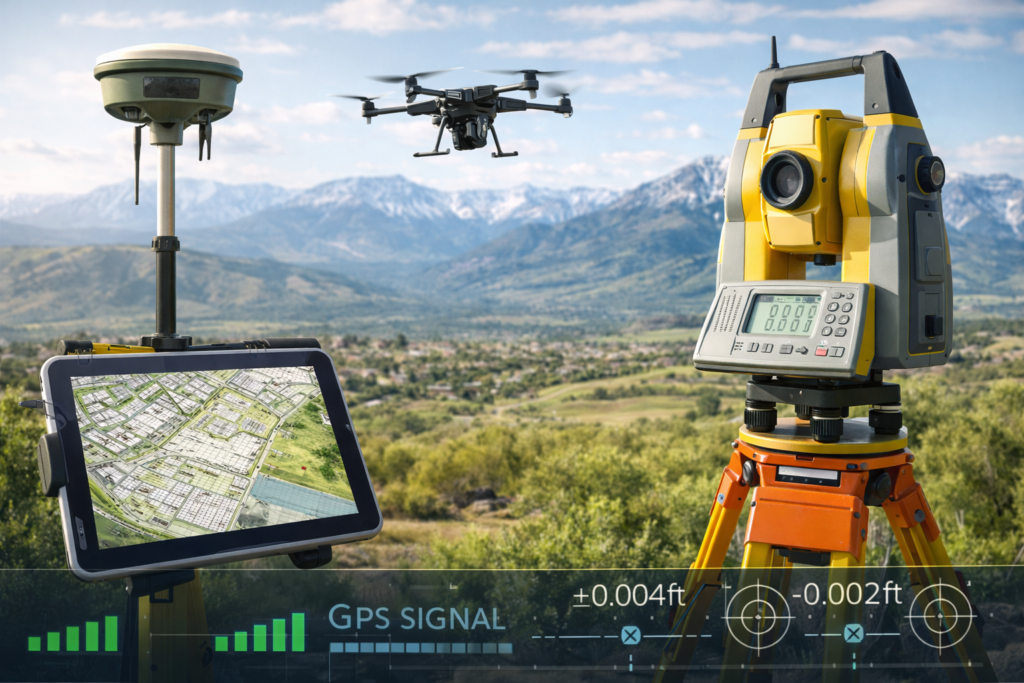
- Sonar technology. Side‑scan and multi‑beam sonar emit sound waves that bounce off the lake or river bottom. The returning echoes are converted into depth measurements. Multi‑beam sonar, sometimes called the “undisputed champion of accuracy”, sends out beams in all directions, creating a dense map of the underwater terrain【113824195896721†L232-L243】.
- Global Positioning System (GPS) and GNSS. Accurate positioning is essential when mapping underwater features. GPS and GNSS receivers provide surveyors with real‑time coordinates, enabling them to precisely geolocate each sonar measurement【486226532011993†L51-L57】. High‑precision GPS units can integrate inclinometers to record elevation changes【113824195896721†L220-L224】.
- LiDAR and remote sensing. Light Detection and Ranging (LiDAR) uses laser pulses from aircraft or drones to measure elevations, including shorelines and shallow water. LiDAR data combined with aerial imagery helps generate digital elevation models and flood maps, identifying areas prone to flooding【486226532011993†L61-L68】. Satellite imagery and radar sensors provide real‑time monitoring of water levels and flood extent【486226532011993†L82-L90】.
- Video and photographic documentation. Waterproof cameras and remotely operated vehicles (ROVs) record visual information about underwater structures, vegetation or debris. This footage can be invaluable when designing dock foundations or assessing potential hazards【113824195896721†L247-L254】.
These technologies allow surveyors to gather data efficiently and safely, even in deep or murky water. The raw measurements are processed in specialized software to generate 3D models, contour maps and cross‑sections that clients can understand.
When should homeowners consider a hydrographic survey?
Hydrographic surveys aren’t necessary for every waterfront property. However, you should consider hiring a licensed surveyor when:
- Buying or selling property with water access. An underwater survey can confirm that docks, boathouses or irrigation intakes are within the deeded boundary and meet regulatory setbacks.
- Planning construction or improvements near water. Whether you’re adding a retaining wall, dredging a canal or expanding a boat ramp, a survey will reveal underwater slopes and subsurface conditions, informing engineering design and cost estimates.
- Evaluating flood risk or insurance requirements. If your home is in or near a floodplain, combining topographic and hydrographic surveys can help determine base flood elevations for insurance purposes. Elevation certificates and flood maps often rely on both types of data【486226532011993†L39-L47】.
- Maintaining irrigation systems. Property owners who rely on river or ditch water need to monitor sedimentation around intakes and pumps. Regular hydrographic surveys can detect buildup before it reduces flow or causes damage.
- Resolving water rights disputes. Conflicts over canal alignments or water usage sometimes hinge on the location of channels and diversions. Hydrographic maps prepared by the Division of Water Rights are crucial evidence in adjudication cases【601813754876556†L11-L19】.
How hydrographic surveys complement other surveying services
Hydrographic surveys rarely stand alone. They work hand‑in‑hand with:
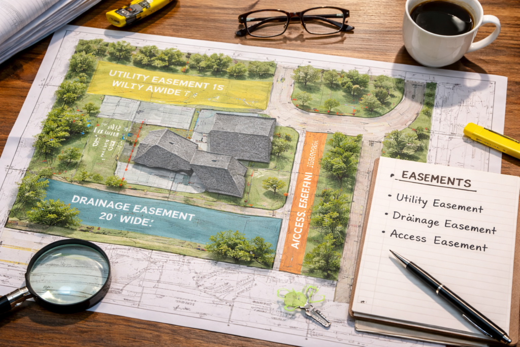
- Boundary and ALTA/NSPS surveys. A standard boundary survey establishes legal property lines on land, while an ALTA/NSPS survey (often used in commercial transactions) adds detail about easements, rights‑of‑way and improvements. For waterfront parcels, combining these surveys with an underwater survey ensures both the land and water portions of the property are accurately described.
- Topographic surveys. As the flood risk article notes, topographic surveys define elevation characteristics and help determine floodplain boundaries【486226532011993†L39-L47】. When merged with hydrographic data, they allow engineers to model how water will flow across the land during storms or snowmelt.
- Drone and aerial mapping. Unmanned aircraft can quickly capture high‑resolution imagery of large areas. When equipped with LiDAR and multispectral sensors, they provide the perfect bridge between terrestrial and hydrographic surveys, mapping shorelines and shallow water where boats can’t reach.
Cook Surveying’s hydrographic expertise
Cook Surveying is headquartered in Salt Lake City but works across Utah. Their experienced team provides hydrographic surveys alongside traditional boundary, GIS and topographic services【532471753822691†L78-L86】. Using GNSS equipment, robotic total stations and remote sensing, they can map rivers, reservoirs and irrigation canals safely and efficiently. The company’s mission is to deliver high‑quality, cost‑effective surveying solutions and customer satisfaction【532471753822691†L78-L86】. When you hire Cook Surveying, you’re not only getting a set of underwater soundings—you’re tapping into decades of local expertise.
Related reading and internal links
For a deeper dive into other surveying services you may need as a homeowner, check out our previous article on Utah land surveying services and how to choose the right survey. That guide explains the differences between boundary, topographic, ALTA/NSPS and construction staking surveys, and offers tips on hiring a licensed surveyor. Together, these articles provide a holistic overview of how surveying protects your property—both above and below the waterline.
Final thoughts
Understanding what lies beneath your waterfront property is more than a curiosity—it’s an essential step in protecting your investment and ensuring compliance with Utah water laws. Hydrographic surveys map underwater depths, document water boundaries and provide the data engineers need to design safe structures. Combined with topographic and boundary surveys, they offer a complete picture of your property and its exposure to flood risk. When the time comes to build, buy or litigate, working with an experienced, licensed surveyor like Cook Surveying gives you peace of mind.
For more details on hydrographic surveying methods, visit NOAA’s hydrographic survey guide. To understand global hydrographic standards, see the International Hydrographic Organization’s guidelines.pographic and boundary surveys, they offer a complete picture of your property and its exposure to flood risk. When the time comes to build, buy or litigate, working with an experienced, licensed surveyor like Cook Surveying gives you peace of mind.