Article #2 — “What is the most accurate land survey?”
Title: What Is the Most Accurate Land Survey? Meta Description: Wondering what the most accurate land survey is? Learn which survey methods deliver the highest precision and when you need them for your Utah property. Primary Keyword: most accurate land survey Secondary Keywords: accurate land survey methods, precise land surveying Utah, boundary survey accuracy, best land survey type Image Prompt: A land surveyor operating a high-precision total station on a tripod in a wide open Utah landscape, clear blue sky, red rock terrain in the background, photorealistic, horizontal composition, no text overlay, 1536×1024.
What Is the Most Accurate Land Survey?
Introduction
If you’re dealing with a property boundary, planning a construction project, or resolving a legal dispute over land, you’re probably asking: what is the most accurate land survey? It’s a smart question, because not all surveys are created equal. Some are designed for a quick overview while others are built for pinpoint precision. Knowing which survey type delivers the highest accuracy — and when you actually need it — can save you time, money, and a lot of headaches down the road.
What Makes a Land Survey Accurate?
Before comparing survey types, it helps to understand what accuracy actually means in surveying. Accuracy refers to how close a measurement is to the true position of a point on the ground. In land surveying, this is measured in fractions of an inch or in parts per million.
Several factors affect survey accuracy:
- The equipment used, such as total stations, GPS receivers, and levels
- The skill and experience of the licensed surveyor
- Environmental conditions like weather, vegetation, and terrain
- The quality of existing records, monuments, and reference points
- The survey method chosen for the project
Utah’s varied terrain — from the flat salt flats of the west to the steep canyon country of the south — adds an extra layer of complexity that experienced surveyors know how to manage.
The Most Accurate Types of Land Surveys
Boundary Surveys
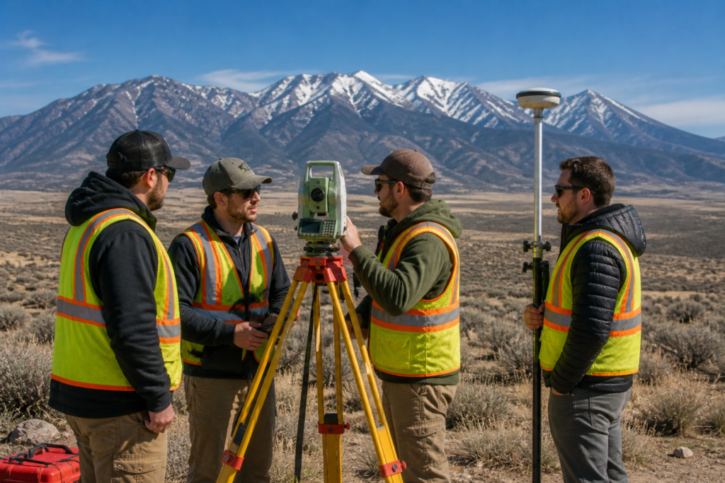
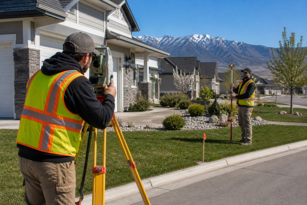
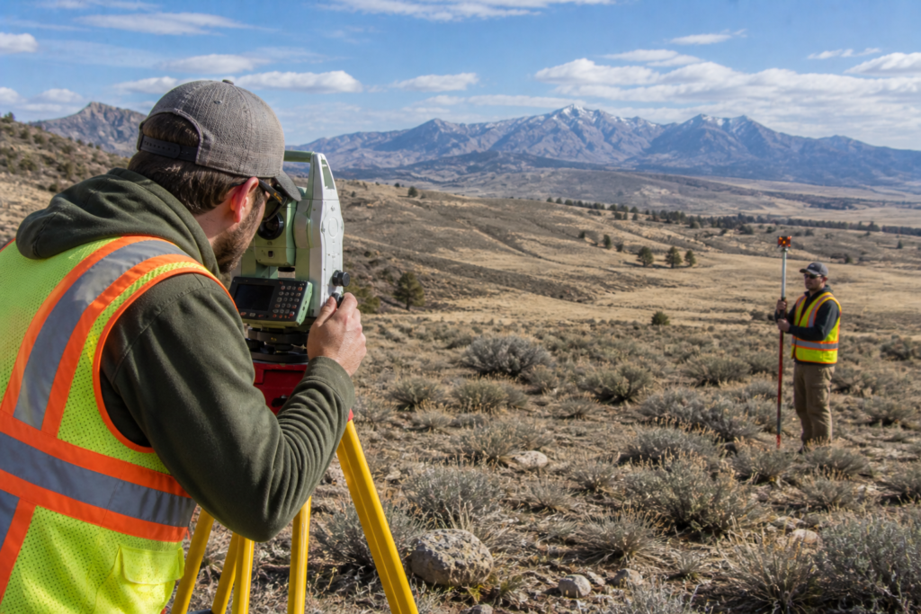
A boundary survey is one of the most precise and commonly requested survey types. It establishes the exact legal boundaries of a property using historical records, deeds, existing monuments, and precise field measurements. Licensed surveyors use total stations and GPS equipment to locate corners and verify property lines to within a fraction of an inch.
Boundary surveys are the go-to choice when:
- You are buying or selling property
- You want to build a fence, structure, or addition near a property line
- A neighbor is disputing your property boundaries
- You need to subdivide land
In Utah, boundary surveys must be performed by a licensed Professional Land Surveyor (PLS) and are legally binding documents.
ALTA/NSPS Land Title Surveys
ALTA/NSPS surveys are widely considered the gold standard of land surveying accuracy. They follow a strict set of national standards set jointly by the American Land Title Association and the National Society of Professional Surveyors. These surveys are incredibly detailed and cover property boundaries, easements, encroachments, utilities, improvements, and more.
ALTA surveys are most commonly required for:
- Commercial real estate transactions
- Lender and title company requirements
- Large development projects
- Complex properties with multiple easements or encroachments
If you want to learn more about this survey type, check out our article on What Is an ALTA/NSPS Land Title Survey and When Is It Needed?
Topographic Surveys
Topographic surveys measure the elevation and shape of the land rather than just its boundaries. While they serve a different purpose than boundary surveys, they are extremely precise when it comes to capturing elevation data, contours, and surface features.
These surveys are essential for:
- Engineering and construction planning
- Drainage and grading design
- Environmental assessments
- Development projects on sloped or uneven terrain
Utah’s dramatic elevation changes make topographic surveys especially important here. A hillside lot in the Wasatch Front or a desert parcel near St. George requires detailed topographic data before any responsible building can begin.
Control Surveys
Control surveys are the most technically precise surveys performed. They establish a network of reference points — called control points — with extremely high positional accuracy. These control points are then used as the foundation for all other survey work in an area.
Control surveys are typically used for:
- Large infrastructure projects like highways and bridges
- Government mapping programs
- Scientific and geodetic research
- Projects covering large geographic areas
How Modern Technology Improves Survey Accuracy
Today’s surveyors use tools that were unimaginable just a few decades ago. Modern equipment has pushed the limits of what’s possible in the field.
Key technologies include:
- Total stations — combine electronic distance measurement with angle measurement for highly precise data collection
- Real-Time Kinematic (RTK) GPS — delivers centimeter-level accuracy by using satellite data combined with a fixed base station
- Drone mapping — captures aerial data across large areas quickly and accurately
- 3D laser scanning — creates highly detailed point clouds of surfaces and structures
At Cook Surveying & Associates, we use modern technology across all of our projects, from traditional boundary surveys to advanced drone mapping services, to deliver the most accurate results possible for our Utah clients.
Which Survey Is the Most Accurate?
The honest answer is that it depends on what you need. Here’s a quick breakdown:
- ALTA/NSPS survey — most accurate and comprehensive for commercial and complex properties
- Boundary survey — most accurate for establishing legal property lines on residential and rural land
- Control survey — most technically precise, used as a foundation for large-scale projects
- Topographic survey — most accurate for capturing elevation and terrain data
For most Utah homeowners and property buyers, a boundary survey performed by a licensed PLS using modern equipment will deliver all the accuracy they need. For commercial transactions or complex developments, an ALTA/NSPS survey is the right call.
Key Takeaways
- Survey accuracy depends on equipment, surveyor skill, terrain, and method
- ALTA/NSPS surveys are the most comprehensive and accurate for commercial properties
- Boundary surveys are the standard for legal property line determination
- Modern tools like RTK GPS and total stations have dramatically improved accuracy
- Always hire a licensed Professional Land Surveyor for legally binding results
- Utah’s terrain requires surveyors with local knowledge and experience
Helpful Resources
- National Society of Professional Surveyors (NSPS) — sets the national standards for survey accuracy and professional practice
- Utah Association of Land Surveyors (UALS) — Utah-specific guidance, licensing information, and professional standards
Conclusion
So what is the most accurate land survey? For legal boundary work, a boundary survey or ALTA/NSPS survey performed by a licensed surveyor using modern equipment is your best option. For elevation and terrain data, a topographic survey delivers the precision you need. The right choice always depends on your specific project and goals.
Whatever your situation, the most important step is hiring a qualified, licensed Professional Land Surveyor who knows Utah’s land, laws, and terrain. At Cook Surveying & Associates, we bring over two decades of experience to every project we take on.
Contact Cook Surveying & Associates today to find out which survey is right for your property.